Zoom
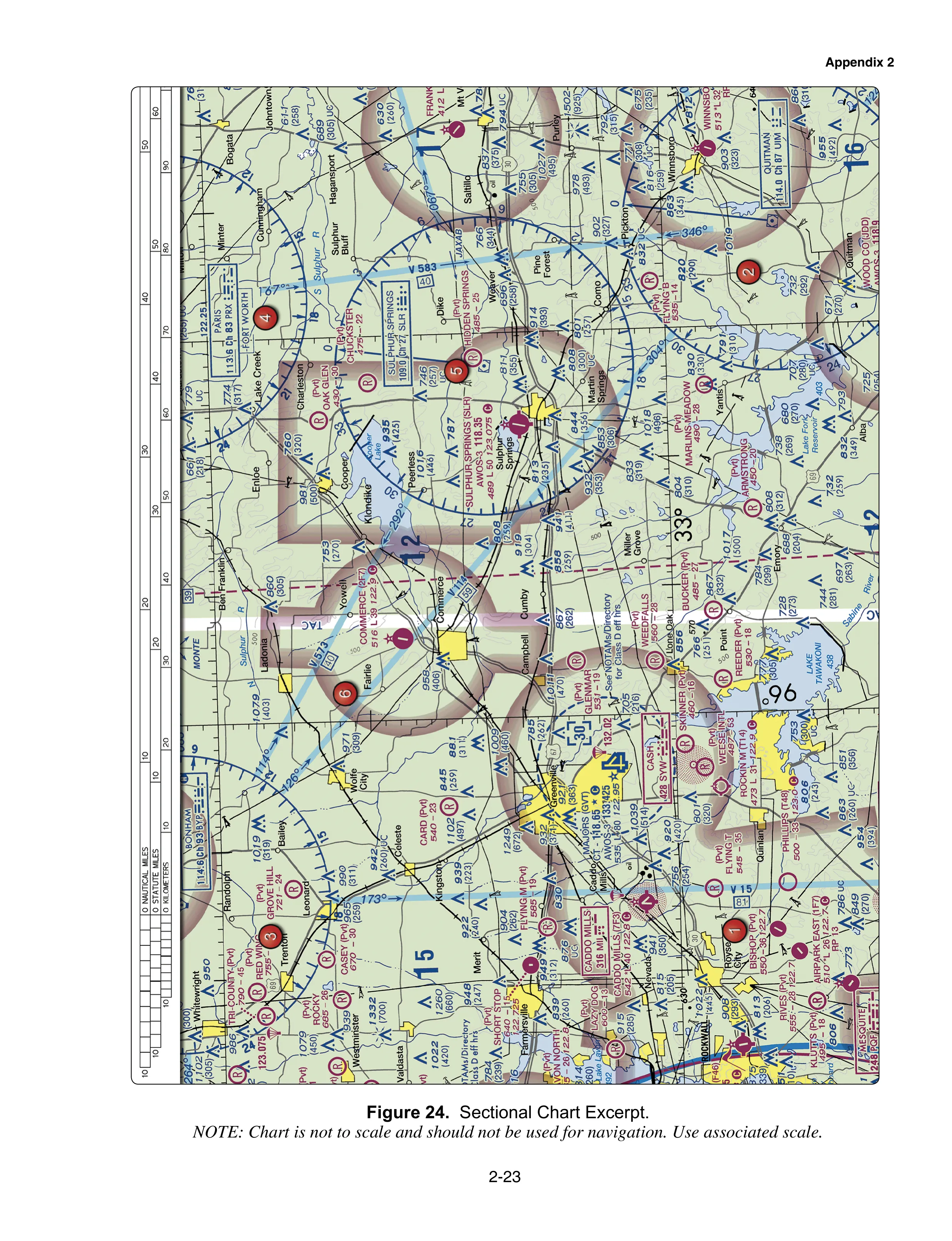
FAA-CT-8080-2H · Figure 24 · page 2-23 ↗ Sectional Chart Excerpt. Opens the FAA’s own PDF at this page.
Figures reproduced from FAA-CT-8080-2H, a U.S. Government publication. Checkride107 is independent prep, not affiliated with or endorsed by the FAA.
What to look for
From the wording of Legend 1. Switch to the legend above the image to check any symbol.
- Airports with control towers are printed in blue; all others are magenta.
- An airport data line reads elevation, lighting, then the longest runway in hundreds of feet. A dash means that item is lacking.
- Beside an obstruction, the upper number is the top above mean sea level; the number in parentheses is its height above the ground.
- A circled C marks the common traffic advisory frequency.
- RP followed by runway numbers means those runways use a right-hand traffic pattern.